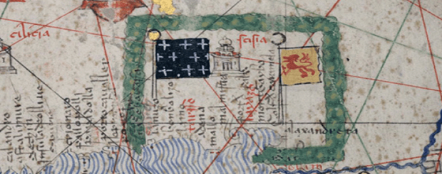
peopleofar – Armenian Kingdom of Cilicia on medieval European maps
OCTOBER 13, 2019 – GEOGRAPHY – HISTORY: Start – previous:
The Armenian Kingdom of Cilicia was established during the High Middle Ages amid fierce religious wars by the Rubenid dynasty, an offshoot of the larger Bagratid family, which at various times had held the thrones of Armenia and Georgia. Their capital was originally at Tarsus, and later became Sis.
Cilicia was a strong ally of the European Crusaders, and saw itself as a bastion of Christendom in the East. It also served as a focus for Armenian nationalism and culture, since Armenia proper was under foreign occupation at the time. Cilicia’s significance in Armenian history and statehood is also attested by the transfer of the seat of the Catholicos of the Armenian Apostolic Church, spiritual leader of the Armenian people, to the region.
Its special relation with the Crusaders was described by Pope Gregory XIII in his Ecclesia Romana:
“Among the good deeds which the Armenian people has done towards the church and the Christian world, it should especially be stressed that, in those times when the Christian princes and the warriors went to retake the Holy Land, no people or nation, with the same enthusiasm, joy and faith came to their aid as the Armenians did, who supplied the Crusaders with horses, provision and guidance. The Armenians assisted these warriors with their utter courage and loyalty during the Holy wars.”
Cilician Armenians had an important impact on Crusaders returning to the West, most notably with the architectural traditions. Europeans incorporated elements of Armenian castle-building, learned from Armenian masons in the Crusader states, as well as some elements of church architecture. Most Armenian castles made atypical usage of rocky heights, and featured curved walls and round towers, similar to those of the Hospitaller castles Krak des Chevaliers and Marqab.
Cilician Armenia had a thriving economy, with the port of Ayas serving as a center for East to West trade. Marco Polo on his travels to the east passed through Cilicia and spoke of Ayas in his renowned book, The Description of the World as:
“a city of good and great and of great trade”


ORIGINE SOURCES-peopleofar.com/2019/10/13/armenian-kingdom-of-cilicia-on-medieval-european-maps/
