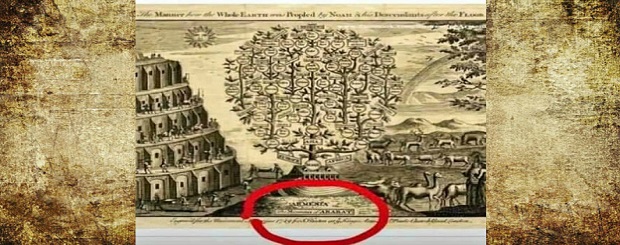
Armenia is the basis of the family tree of the nations and states of the world. Museum of London
DECEMBER 30, 2020 – COUNTRY OF ARMENIA. Yerevan Times:
Armenia is the basis of the family tree of the nations and countries of the world. The family tree is in the London Museum in England.
When talking about Armenia on the world stage, the most essential fact that we mention is that Armenia was the first to accept Christianity as a state religion.
But it is more than strange that before jesus christ at 6th century Armenia is one of the three countries on the 6th century Babylonian clay map, that is, for more than 2,600 years, we have our place on the world’s oldest map.
For our ancestors, the world was a piece of land, the shores of which were flooded on all sides. Fortunately, however, they did not limit themselves to what they knew; they continued to make new attempts to “measure” the world.
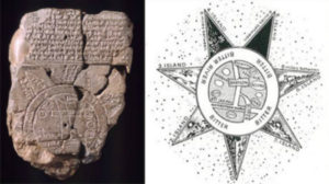
The oldest map of the world is the Babylonian map before jesus christ at 6th century. On this map is Babylon in the center of the world, and in the northwestern part, Armenia, Armenia, and Syria. Around them is the “bitter river”. The 7 points on the other side of the river are islands where it is impossible to reach. It turns out that Armenia is the only modern country that was depicted on the ancient map of the world.
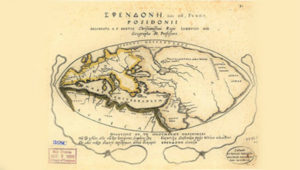
The map of Poseidonius (before jesus christ in 2nd century) expands our understanding of the world. In his map, the lands of ancient Greece are joined by the lands written by Alexander the Great. By the way, this map also shows Armenia in the center of the world.
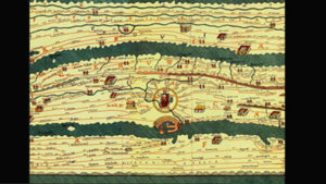
The map of Pinger (4th century) clearly shows all the roads leading to Rome. The complete map is quite long. It depicts the world from the Iberian Peninsula to India. The map shows the ancient communication routes of Europe, Asia and Africa, the cities and stations located on them, the distances between the latter, as well as the main highways of the Kingdom of Greater Armenia.
yerevan-times.com/65419841651498-2/
English translation – LOUSAVOR AVEDIS:
